Hiking in the La Sal Mountains
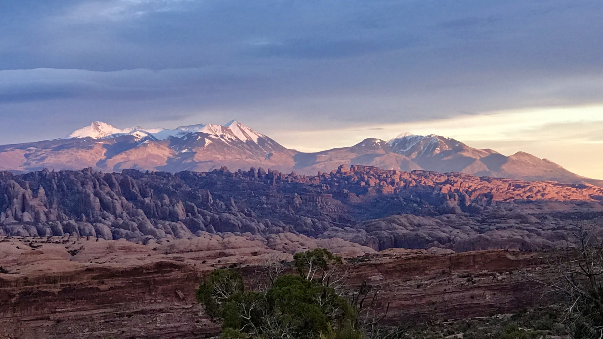
The La Sal Mountains offer a stunning escape from the desert landscapes of Moab. Rising majestically above the surrounding red rock country, these mountains provide a diverse range of hiking opportunities, from challenging alpine ascents to serene forest walks. This guide focuses specifically the La Sal Mountains, highlighting trails that offer unique perspectives, breathtaking views, and a chance to experience the cooler, forested environments of this remarkable range.
Whether you are a seasoned hiker seeking a strenuous climb or a casual walker looking for a peaceful stroll amidst nature, the La Sals have something to offer. This guide provides detailed information on selected trails, including trailhead access, mileage, and key features, to help you plan your adventure responsibly and safely.
Mount Waas
Mount Waas stands as a magnificent sentinel in Utah’s La Sal Mountains, offering hikers one of the most rewarding summit experiences in the American Southwest. At 12,331 feet above sea level, this peak serves as Grand County’s highest point and provides breathtaking panoramic views that stretch across the red rock country of Moab, the Colorado River valley, and the distant peaks of Colorado.
Bull Canyon Dinosaur Track Trail
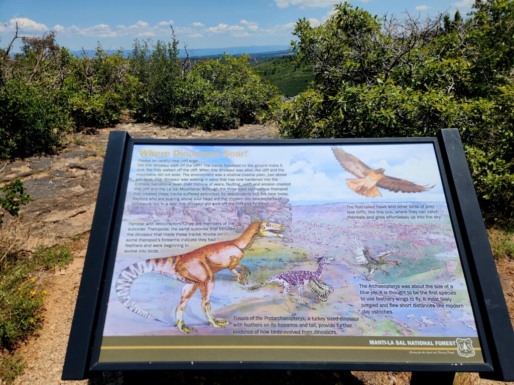 The Bull Canyon Dinosaur Track Trail is a short, family-friendly hike that packs an extraordinary amount of natural and paleontological interest into a brief but memorable experience. This trail exemplifies the concept that great things come in small packages, offering visitors the chance to see genuine dinosaur footprints preserved in Entrada Sandstone while enjoying some of the most spectacular views in the La Sal Mountains region.
The trail’s brevity should not be mistaken for lack of substance. Within this short distance, hikers encounter multiple sets of dinosaur tracks, interpretive signage that provides context about the prehistoric environment, and viewpoints that showcase the dramatic landscape carved by millions of years of geological processes. The trail has been thoughtfully developed with a graveled pathway, protective fencing around the most significant track sites, and educational materials that enhance the visitor experience without detracting from the natural setting.
What makes this trail particularly special is its accessibility to visitors of all ages and fitness levels. Families with young children, elderly hikers, and those with mobility limitations can all enjoy this remarkable paleontological site. The easy grade and short distance mean that the focus remains on observation, education, and appreciation rather than physical challenge. This accessibility has made Bull Canyon Dinosaur Track Trail one of the most visited paleontological sites in the Moab area, drawing thousands of visitors annually who come to witness these ancient traces of life.
Carpenter Ridge – Buckeye Recreation Area
The Carpenter Ridge – Buckeye Recreation Area, situated predominantly in western Colorado, extends into the eastern side of the La Sal Mountain range. This area is a haven for outdoor enthusiasts, offering spectacular mountain scenery, camping, hiking, motorized trails, fishing, and hunting opportunities. While specific hiking trail mileages and loop options within this broad recreation area are not detailed in the primary source, its diverse landscape suggests numerous possibilities for exploration.
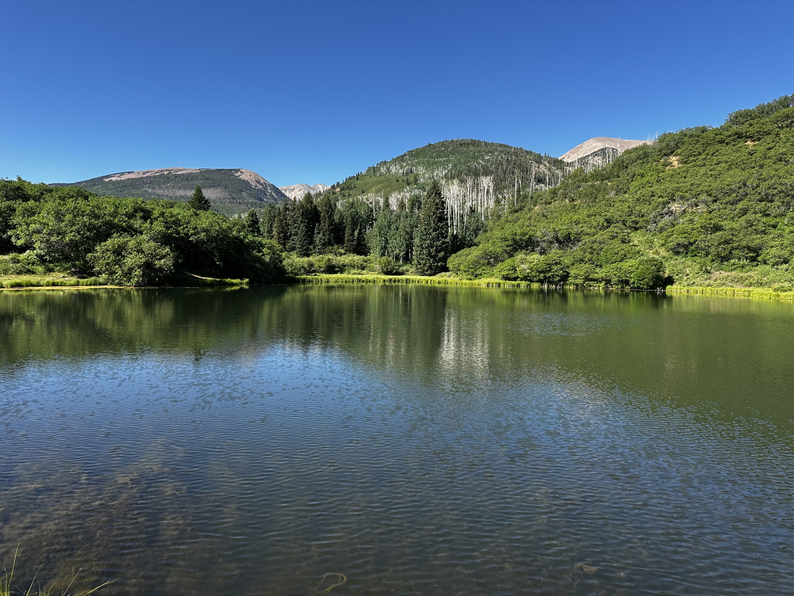
Warner Lake
Warner Lake is a scenic mountain lake offering easy access to several trails and a popular campground. It’s a great starting point for various hiking experiences, from short strolls around the lake to longer, more challenging routes.
- Type: Various trails, including out-and-back and loops.
- Mileage: Varies depending on the trail. The Warner Lake/Beaver Basin Trail is 5.1
miles long. A short trail around the lake is approximately 0.6 miles. - Elevation: Warner Lake is located at an elevation of 9,400 feet. Trails from Warner Lake can gain significant elevation.
- Difficulty: Easy to Strenuous, depending on the chosen trail.
- GPS Coordinates (Warner Lake Campground):
- Latitude: 38.528333, Longitude: -109.233333
Burro Pass
Burro Pass is a significant point in the La Sal Mountains, often part of longer routes like “The Whole Enchilada” mountain biking trail. It offers challenging hiking with substantial elevation changes and rewarding views.
- Type: Point-to-point (often part of longer loops or traverses)
- Mileage: Approximately 2.4 miles (Burro Pass Trail #315) to 7.0 miles. Can be part of much longer routes.
- Elevation: Summit at approximately 11,150 – 11,216 feet. Elevation gain can be significant depending on the starting point (e.g., 700 feet climb in less than 1 mile to the top of Burro Pass).
- Difficulty: Strenuous / Moderately challenging.
- GPS Coordinates (Burro Pass Trailhead – near Warner Lake Campground):
- Latitude: 38.528333, Longitude: -109.233333
Gold Knob
Gold Knob, at 11,055 feet, is one of the lower peaks in the La Sal Mountains, offering a challenging but rewarding hike with significant elevation gain. The trail provides excellent views of the surrounding area.
- Trail Name: Gold Knob Trail
- Type: Out-and-back
- Mileage: Approximately 3.9 miles (round trip)
- Elevation: Summit at 11,055 feet, with a gain of approximately 1600 feet.
- Difficulty: Highly challenging / Strenuous
- Estimated Time: 2 hours 54 minutes to 4 hours (hiking)
- GPS Coordinates (Trailhead – Warner Lake Campground):
- Latitude: 38.508333, Longitude: -109.208333
Safety Tips and General Recommendations
Hiking in the La Sal Mountains, especially on the eastern side, offers incredible rewards but also requires careful preparation and awareness. The mountainous terrain, variable weather conditions, and remote nature of some trails necessitate adherence to safety guidelines.
- Check Weather Conditions: Mountain weather can change rapidly. Always check the forecast before heading out and be prepared for sudden shifts in temperature, precipitation, and wind. Snow can persist at higher elevations well into the summer months.
- Proper Gear: Wear appropriate hiking boots, layers of clothing, and carry essentials such as a map, compass or GPS device, sufficient water, high-energy snacks, a first-aid kit, sun protection, and a headlamp.
- Stay on Marked Trails: To protect the fragile ecosystem and ensure your safety, always stay on designated trails. This also helps prevent erosion and minimizes impact on the natural environment.
- Inform Others: Let someone know your hiking plans, including your intended route and estimated return time. This is crucial in case of an emergency.
- Altitude Sickness: The La Sal Mountains reach high elevations. Be aware of the symptoms of altitude sickness (headache, nausea, dizziness) and descend if symptoms worsen. Acclimatize gradually if coming from lower elevations.
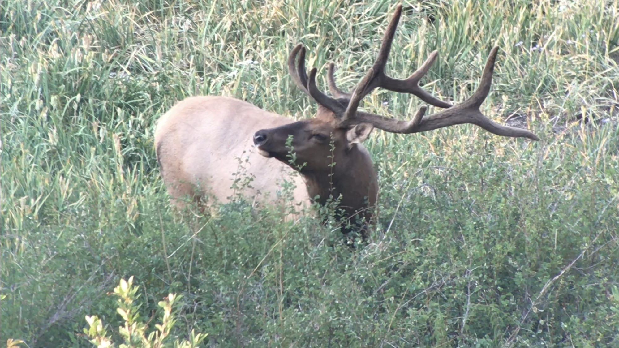
- Wildlife Awareness: The La Sals are home to various wildlife. Be aware of your surroundings, store food properly to avoid attracting animals, and know how to react if you encounter wildlife.
- Leave No Trace: Practice Leave No Trace principles: pack out everything you pack in, dispose of waste properly, respect wildlife, and minimize impact on the land.
- Water Sources: Natural water sources may be scarce or unreliable. Carry enough water for your entire hike, or be prepared to filter/treat water from reliable sources.
- Emergency Preparedness: Carry a fully charged cell phone, but be aware that service can be spotty in remote areas. Consider carrying a satellite messenger or personal locator beacon for emergencies.
Enjoy the unparalleled beauty and tranquility of the La Sal Mountains, and remember to hike responsibly and safely!
Other Area Attractions & Activities
Hunting
Fishing
Photography
ATV / UTV / MOTO

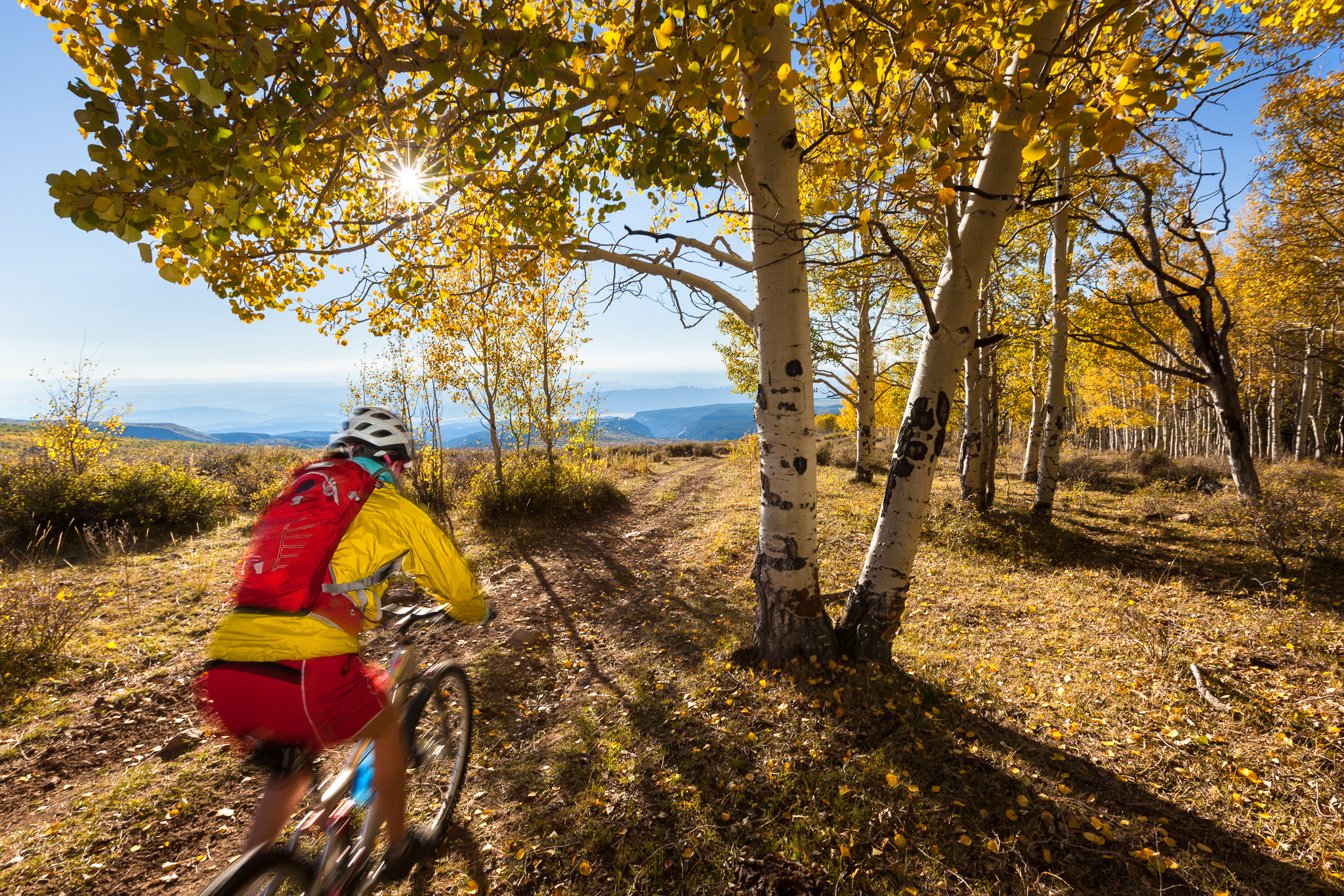
Mountain Biking